
Trace a Manhattan Beach Street Directory Address
A reliable street directory search moves from place to person and then back to the record. Standardize the address first. A street number, direction, suffix, ZIP, former road name, or tract label can change the result. Then keep the parcel key separate from any conclusion about the people who used it.
- Standardize the address. Check the USPS address lookup and the city's street index for spelling, road segment, and ZIP details.
- Find the parcel. Enter the situs address in the Assessor Portal, record the AIN and legal description, and note the map position.
- Bridge to an owner name. Use a lawfully available deed or counter record, or a known party name, because the county web result does not provide an open owner-name search.
- Follow the deed. Carry the grantor or grantee name and approximate year to the Norwalk recorder index, then retrieve the instrument and confirm its legal description.
- Add people and history carefully. Compare an authorized voter source, city permit, reverse directory, census entry, obituary, or court file without treating one role as proof of present residence.
This address-to-owner-to-deed-to-voter-and-history chain is the core of the Manhattan Beach street directory. It works because each step has a clear keeper and a known limit.
Start Manhattan Beach Street Records at the Assessor
The Los Angeles County Assessor Portal is the most useful public starting point for a current street. It accepts an AIN or street address, with Basic Search, Legal Search, and Map Search modes. A parcel result can show the situs, AIN, legal description, property use and characteristics, assessed land and improvement values, tax-rate area, and map position. The public web path does not offer an unrestricted owner-name search.
Use the situs as the physical location. Keep it distinct from a mailing address, which may point to a trust, agent, office, or different city. An assessment value is not a current sale price. A homeowners exemption can be an owner-occupancy clue, but it does not identify every resident or household member.
The Los Angeles County Assessor property-search explanation shows the address-first route used by a Manhattan Beach street directory.
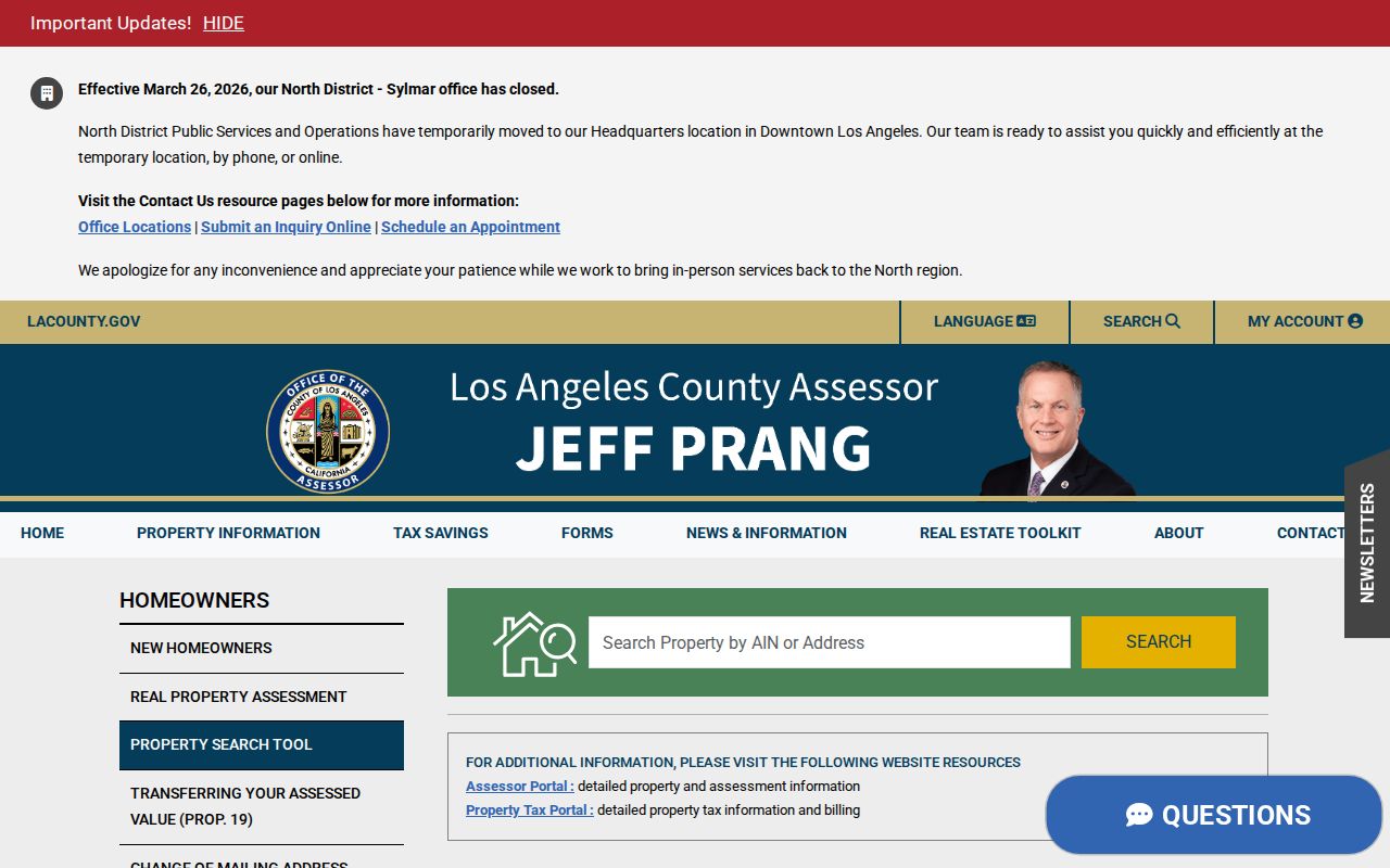
The parcel view gives the AIN that can be checked against GIS, permits, tax material, and a later deed record.
| Assessor field or control | Search meaning |
|---|---|
| Search by AIN or Address | Accepts the ten-digit parcel key or standardized situs. |
| Basic Search | Primary address and AIN route. |
| Legal Search | Emphasizes legal-description information. |
| Map Search | Supports pan, zoom, and parcel selection. |
| Records Effective date | Marks the roll date shown by the portal. |
- Parcel
- A mapped piece of land identified by the county's AIN and legal description.
- Situs address
- The physical location of the parcel, used by the Assessor, GIS, and permit systems.
- Plat
- A recorded or mapped plan that shows lots, blocks, streets, and subdivision relationships.
- Criss-cross directory
- A reverse format that reorders a surviving directory by street or address; its presence and fields must be checked in the actual volume.
Walk Manhattan Beach Streets Through GIS
The Manhattan Beach Interactive Mapping viewer supplies the visual block layer after its “I AGREE” disclaimer. Search an address when available, zoom until separate parcel shapes appear, click the subject parcel, and then inspect the parcels touching either side, rear, and across the street. Use the AIN and situs from each popup as a research note.
GIS is a map and context tool, not a guaranteed title record or people list. Layer availability can change. Zoning, district, infrastructure, and basemap information can explain a street setting, but a mapped polygon does not establish occupancy. Compare a parcel click with the county Assessor before carrying a number into a deed search.
| GIS control | Street-directory use |
|---|---|
| I AGREE | Accepts the viewer's as-is disclaimer before launch. |
| Address or location search | Zooms toward a known point when available. |
| Layer list | Turns parcel, zoning, district, or infrastructure layers on when offered. |
| Basemap selector | Changes the background used to read street context. |
| Zoom, pan, and home | Moves along the block and restores the map view. |
| Identify or click parcel | Opens mapped attributes for the selected shape. |
| Measure, select, or print | Use only when the live viewer exposes the control. |
A simple sample inventory is the clicked parcel boundary, AIN or parcel identifier, situs context, adjacent shapes, selected layers, and scale. It should also record the map disclaimer and the fact that no resident list is supplied.
Address-Keyed Manhattan Beach Street Directory Records
The street directory is a chain of address-keyed records, not one database. The coverage table keeps the modern sources in their proper roles. Some are free online. Some are counter-only. Some require a request or an authorized purpose.
| Record set | Keeper | Address evidence | Access |
|---|---|---|---|
| Assessor parcel | Los Angeles County Assessor | AIN, situs, legal description, values, characteristics | Free address/AIN portal |
| City and county GIS | Manhattan Beach and County Assessor | Parcel shape, adjacent lots, public map layers | Free map after disclaimer |
| Recorded instruments | LA County RR/CC | Grantor, grantee, legal description, transfer instrument | Name/year index at Norwalk |
| Permits and code cases | Manhattan Beach Community Development | Project address, roles, inspections, case dates | CSS, public computer, or CPRA |
| Voter data | California Elections | Authenticated record or approved file fields | Self-only or authorized request |
| Reverse directory or census | Library, archive, or historical collection | Listed subscriber or historic household | Physical, licensed, or reference access |
| City minutes and petitions | Manhattan Beach City Clerk | Block projects, notices, public action, named participants | OnBase, CPRA, or archive request |
The parcel key ties the map to the Assessor. A known party name and legal description tie the parcel to a deed. A date, permit number, or street segment makes a city request workable. A historical directory or census adds people who never appear in a title record.
Why Manhattan Beach Deeds Skip Street Search
Los Angeles County deeds cannot be searched by street because the RR/CC real-estate index is organized by grantor, grantee, and recording year. The county states that it cannot search the index by property address and does not accept telephone index searches. A street number can start the parcel research, but it cannot be carried directly into the deed index as the search key.
The recorder deed-search limits confirm the rule. The deed record remains public at the Norwalk access point, with records from 1851 through 1957 on the lower level and records from 1958 to the present on the second floor.
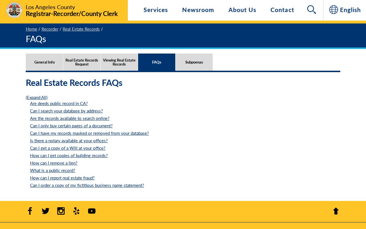
The counter image reflects an access rule, not a missing record span. Copy requests can be made in person, by mail, fax, or the county's online route. The recorder's request page states that processing can take 20 working days, and a complete document must be ordered rather than selected by favored pages.
Myth check. Public does not mean web searchable. The address-to-AIN-to-known-party bridge is required before a deed chain can be read.
Build a Manhattan Beach Deed Chain from an Address
A deed chain follows recorded transfers backward. It does not promise a list of occupants. Use the legal description and AIN to keep the chain on the right land, especially when a surname is common or a trust, estate, or business entity appears.
- Record the current situs, AIN, legal description, map position, and Assessor facts.
- Obtain a known owner or purchase deed through lawful counter or copy channels. The recorder cannot begin from the address alone.
- Search the known current party as grantee around the likely purchase year, then note the grantor, instrument number, recording date, and legal description.
- Search the earlier grantor as a grantee in a prior year. Repeat the bridge while checking the same parcel identity each time.
- Layer in permits, probate, obituaries, directories, and census entries when the question concerns people who used the address rather than title holders.
Insider tip. Start with the document that names a party and a year. A blind sweep of every surname in a county index is slower and more likely to join the wrong parcel.
Manhattan Beach Permits and Code Cases by Address
Community Development's Citizen Self Service system covers permits, plans, inspections, code enforcement, and invoices. Address and date range are the most productive request keys. The public records computer is available for in-person research, but counter research is limited from 11:30 to 1:30. A result may identify an applicant, designer, contractor, owner, or prior participant, so it adds project history rather than a complete resident entry.
When CSS does not show the needed record, use the Manhattan Beach public-records instructions and submit a narrow CPRA request through the City Public Records Center. Official building-plan copies use a special process and may require permissions under Health and Safety Code section 19851. A permit number, address range, inspection date, or code case number helps staff locate an existing record.
Camino Real and Other Manhattan Beach Street Names
Street history can explain why a modern lookup appears empty. Sepulveda Boulevard was formerly Camino Real, and paving of the modern corridor was completed in April 1931. Railroad Drive became the Valley Drive and Ardmore Avenue corridor. Search both the former and current names when a deed, map, newspaper, or directory falls near the change.
El Porto was a separate northern community before annexation into Manhattan Beach. Older material may use El Porto, North Manhattan Beach, a subdivision, or a county description instead of the current city label. The city's map gallery includes a street index and map context that can help bridge those terms. A current address remains the best starting key, but the historic label may be the key that unlocks the older record.
The Manhattan Beach map gallery helps compare today's street pattern with the older names. USPS formatting confirms delivery form and ZIP, not the legal city boundary or the history of a parcel.
Read the Historical Manhattan Beach Street Directory Backward
A surviving reverse or criss-cross directory can reorder a volume by street and house number. Read neighboring entries in sequence, record the exact spelling, and note whether the item is a telephone directory, city directory, or another local list. The Manhattan Beach Historical Society has verified multiple copies of a 1960 phone directory, but exact earlier and later runs require a curator or reference inquiry.
The 1920, 1930, 1940, and 1950 census schedules can add household relationships to a street entry. A directory omission may mean an unlisted phone, another household name, a publication lag, or a move. It does not prove that a person never lived at the address. For the full collection trail, use the Manhattan Beach city directories route, then return to the parcel and deed keys here.
Note: Historical street evidence is strongest when a directory address, census household, map label, and parcel description agree.
What the Manhattan Beach Street Directory Cannot Show
A street directory cannot establish every person who lives at an address. Deeds identify parties to recorded instruments. Assessments identify parcels. GIS identifies mapped relationships. Permits identify project participants. A private household member, unlisted subscriber, utility customer, or driver-address record is not opened by those sources. My Voter Status is self-authenticated, and an authorized voter file is not a casual block request.
Absence can have many causes: a protected address, a sealed record, a nonpublic voter status, a mailing address elsewhere, a trust or estate, a name variant, or a directory that never covered the person. If the question shifts from a whole street to one individual, the Manhattan Beach resident lookup workflow can keep identity checks separate from block research.
Privacy boundary. Address records are available for lawful personal research, family history, civic review, and property questions. Never use a street or name search to stalk, harass, intimidate, impersonate, or harm anyone.
Manhattan Beach Records Requests for Missing Addresses
When an online search ends, use the custodian that holds the record. Community Development works from an address and date range. The City Clerk holds municipal minutes, ordinances, archives, and notices. The recorder requires a party name and year. Libraries, the Historical Society, the Superior Court, and National Archives at Riverside handle older collections.
Under the California Public Records Act, Government Code section 7922.535 ordinarily gives an agency ten days to determine whether it holds responsive records. Unusual circumstances can add no more than 14 days. Agencies do not create a new street roster. Ask for an existing permit, map, minute packet, deed copy, or directory volume using an address, date, number, or title.
Note: A precise request preserves the street directory's strongest feature, a clear path from address to custodian to record.