
Manhattan Beach Neighbor Records
Block research works best when each source has a narrow job. A city map locates nearby lots; the assessment record supplies an AIN and property facts; permits add project roles; directories and census schedules may identify households; voter data is restricted. None alone is a current roster. The table separates parcel evidence from address evidence.
| Source | What It Shows About a Block | Access |
|---|---|---|
| City and county GIS | Parcel geometry, adjacent lots, and map layers | Free after disclaimer |
| Los Angeles County Assessor Portal | AIN, situs, legal description, values, and map | Free by address/AIN; no owner-name search |
| Manhattan Beach permits and records | Permit, inspection, and code activity | Browse or request; role limits |
| Reverse directory or census | Historical listed households along a street | Library or archive; years vary |
| Voter file | Registration fields for an approved purpose | Authorized application; not a block list |
| City Clerk and civic files | Petitions, notices, minutes, and public action | City archive or CPRA request |
Here, neighbors means parcels that touch or face the subject parcel. An adjacent polygon does not prove shared occupancy. A deed proves a transfer; an assessment card describes land; a permit identifies a project role. Household evidence needs a directory, census, obituary, or voluntary source. Preserve the AIN and label each conclusion as parcel, owner, project participant, historical household, or voter.
Adjacent Parcels on a Manhattan Beach Block
Use a click-only path from GIS to AIN to Assessor. Manhattan Beach Interactive Mapping opens after an I AGREE disclaimer. Search and layers can change. The city describes the map as general information, not guaranteed accurate or complete. Do not assume a radius, buffer, export, or bulk-owner tool. Select visible parcels one at a time, then cross-check each AIN.
- Enter a standardized address in the city map, or pan and zoom to the block.
- Click the subject parcel and note its AIN, situs, legal description, and mapped layers.
- Click parcels at the sides, rear, and across the street. Keep AIN and situs in street order.
- Enter each AIN or address in the county Assessor Portal. The AIN bridges the polygon and county record.
- For a full street chain, use the Manhattan Beach by-street address records, not the adjacent map.
Map geometry and legal identity should travel together. Manhattan Beach Planning accepts online address changes, yet the AIN and legal description remain the stronger bridge through a rename. Sepulveda was Camino Real; Railroad Drive became Valley Drive and Ardmore Avenue. El Porto's earlier identity can shift a result. Try historical terms, but do not treat a mismatch as a missing neighbor.
GIS Fields for Manhattan Beach Neighbors
GIS controls help reproduce a click, not extract a resident list. Use displayed controls and record the map date for important layers.
| Field or control | Type | Required | Manhattan Beach note |
|---|---|---|---|
| I AGREE | Button | Yes to launch | Accepts the map's as-is disclaimer |
| Address or location search | Text or autocomplete | No | Zooms to the subject when available |
| Layer list | Checkboxes | No | Parcel and public layers depend on the service |
| Basemap | Selector | No | Changes the block background |
| Identify or parcel click | Map interaction | No | Opens attributes for the polygon |
| Zoom, pan, and home | Map controls | No | Supports visible block browsing, not a claimed radius tool |
After a click, capture AIN, situs, parcel shape, street context, and available layers. The Assessor searches by address or AIN, not a public owner-name field. Detail may show property use, characteristics, assessed land and improvements, total value, tax-rate area, map geometry, roll date, and software version. It is an assessment view, not a social map.
Assessment Is Not Residency
Myth check. A property record is not a household record. Situs is the physical location. A mailing address receives tax correspondence and may be a PO box, trust, agent, manager, or address outside Manhattan Beach. A legal description identifies land through lot, block, or tract language. An AIN is the county parcel key. A homeowners' exemption is an occupancy clue, not a list of everyone there.
Open the example Assessor parcel detail to see the parcel card behind a Manhattan Beach neighbors search.
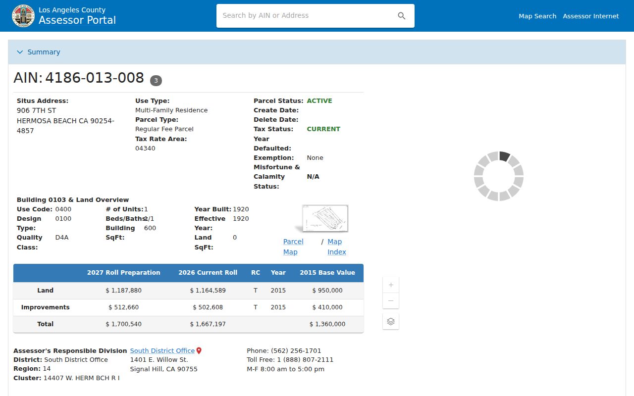
The example route shows how an AIN and parcel facts anchor a search. It is not an unrestricted owner-name or occupant lookup.
Permits and inspections answer a different question. Community Development's Citizen Self Service portal can expose permits, plans, inspections, code cases, invoices, and applications. A permit may name an owner, contractor, architect, or prior owner. It dates work on a structure, not every resident. Plan copies can have special conditions under Health and Safety Code section 19851. Treat permit people as project participants.
Civic Records Around Manhattan Beach Blocks
Municipal paper adds block context. The City Clerk's archive can contain minutes, ordinances, contracts, Form 700 filings, campaign filings, and legislative history. A notice, petition, or project file may explain a parcel's history. The Manhattan Beach public-records request instructions identify useful keys: address and date range, report number and location, an intersection or project, or a business-license number. A defined request is better than an unbounded resident request.
Read the California Public Records Act deadline provision with the city request process.
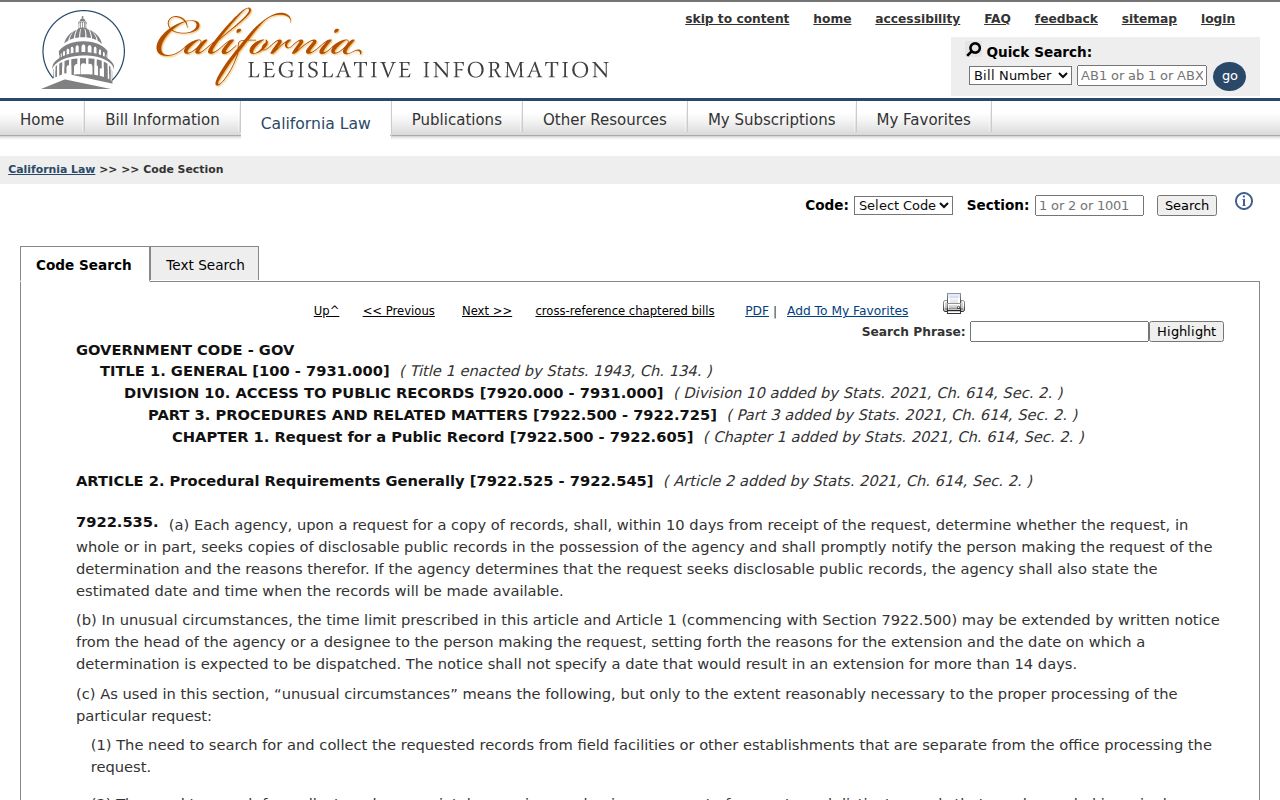
Government Code section 7922.535 ordinarily calls for a determination within 10 days, with up to 14 more for unusual circumstances. That is a response timeline, not an automatic disclosure promise. Exemptions, privacy review, plan-copy rules, and inspection versus certified-copy rules still control.
Permits, minutes, and notices show civic activity, not title or occupancy. A GIS layer, plan file, or petition is evidence of place or public action. Pair it with the AIN and dates before connecting it to a neighbor.
Reading Historical Manhattan Beach Neighbors
Current parcel maps have no memory of everyone who lived nearby. A reverse or criss-cross directory reorders entries by street and house number, if present. An alphabetical directory starts with a surname and may show an address. The Manhattan Beach Historical Society collection updates document more than 1,000 inventoried items and a verified 1960 phone-directory item, but no exhaustive online run or confirmed reverse section. Ask the curator to confirm coverage and format.
Pair the closest directory year with a federal census snapshot. The 1920, 1930, 1940, and 1950 schedules can add household members, relationships, ages, birthplaces, and street address. The Los Angeles County Library Californiana Collection supplies census schedules, newspapers, histories, and city directories. The 1890 census was mostly destroyed, and the 72-year rule keeps a 1960 schedule closed until 2032. A census is a dated snapshot.
The Bruce's Beach records archive combines property maps, files, minutes, ordinances, judgments, court papers, and newspapers. Some pages are hard to read on microfilm. Check duplicate originals, legal descriptions, and newspapers before treating an unreadable page as an absent record.
Manhattan Beach city directories provide collection context for the address entries used near a parcel.
Voter Files and Block Access in California
California voter data is not an open street directory. My Voter Status authenticates a person with name, full date of birth, and a driver license or ID number or Social Security number last four. It is a self-lookup, not a way to reveal nearby neighbors. A full file requires an authorized election, scholarly, journalistic, political, or governmental purpose under Elections Code section 2194 and Government Code section 7924.000. It is not an ordinary CPRA shortcut.
Use California My Voter Status for a self-authenticated record, then review the regulations before a file request.
Read California's voter access regulations about named voters versus unidentified people at a street address.
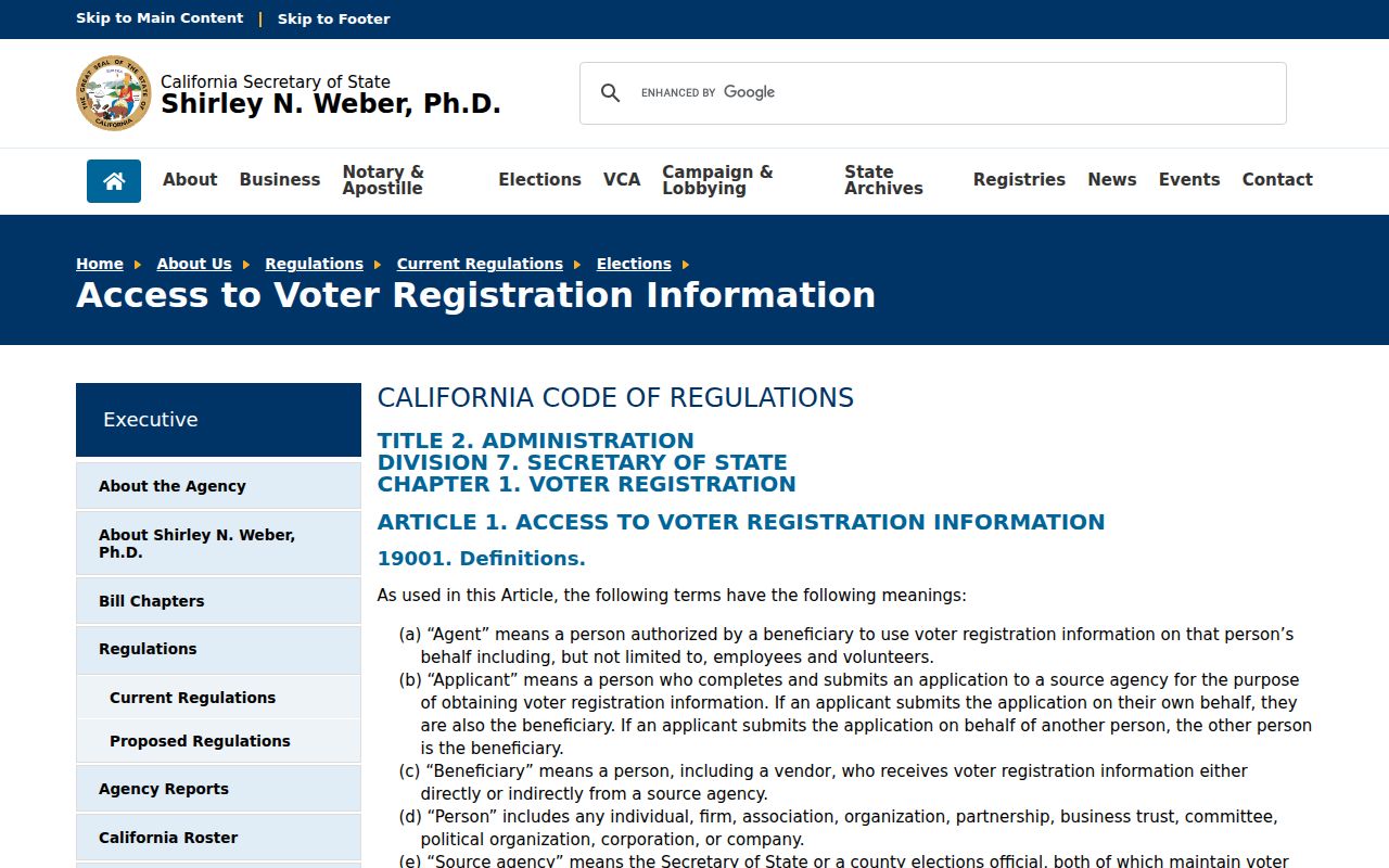
The regulations explain why a casual block request fails. An approved file may include name, date of birth, registration date, address, precinct, contact information, party preference, and participation history, but not ballot choices. Driver license and state ID numbers, Social Security digits, unique identifiers, and signatures are excluded. Safe at Home and other protected records receive special handling.
Manhattan Beach Geography Changes the Search
Address context changes across the city. Downtown Manhattan Beach centers on Manhattan Beach Boulevard and the pier. The Strand has dense west-side parcels and walk streets. North Manhattan Beach and El Porto carry an older separate-community identity. The east side includes later subdivisions and commercial corridors, while Manhattan Village adds another tract. Bruce's Beach has a distinct property and civic-history trail. These are search terms, not interchangeable rosters.
Insider tip. Try historic labels when a directory loses an address. El Porto, Manhattan, Manhattan Beach, and North Manhattan Beach may index the same area differently. Sepulveda was Camino Real; Railroad Drive became Valley Drive and Ardmore Avenue. The city incorporated in 1912 and added “Beach” in 1927, so an old entry may miss a modern city-name search.
No city-maintained umbrella directory or public member roster for Manhattan Beach neighborhood associations was located. Downtown Manhattan Beach Business and Professional Association or Chamber resources are business-member sources, not resident rolls. HOA, congregation, school, club, and block-watch rosters are private or voluntary unless published. The public layer is parcels, permits, civic records, and lawful historical material.
Official Rolls Versus Commercial Tools
Two categories often get blended in a neighbor search. Official records have a custodian, defined fields, a jurisdiction, and an access rule. Commercial neighbor-lookup tools may combine public records with compiled data, but their source trail and refresh date can be unclear.
| Category | What It May Show | Access and Limits |
|---|---|---|
| Official rolls and portals | Parcel geometry, AIN, assessment facts, permit roles, civic files, authorized voter fields, or historical entries | Free, counter, library, or regulated access; verify with the custodian |
| Commercial neighbor-lookup tools | Compiled names, addresses, and possible household associations drawn from mixed sources | May require payment or login; stale, duplicated, incomplete, or uncertain data is possible |
An official result can still be incomplete. A parcel card does not prove occupancy, a permit does not prove residence, a census does not describe today, and a voter file is not a block list. Treat commercial results as leads. Confirm the AIN, date, record type, and source office before repeating a claim about neighbors.
Privacy Limits for Manhattan Beach Neighbors
Some household information is intentionally absent. California's Safe at Home program protects qualifying survivors and threatened public workers with a substitute mailing address under Government Code sections 6205-6211, including section 6208.1. Utility, delivery, DMV, child, and private household-member data are not public substitutes. Corrections belong with the record custodian.
Review California DOJ registry information as a separate public-safety category, not a general neighbor directory.
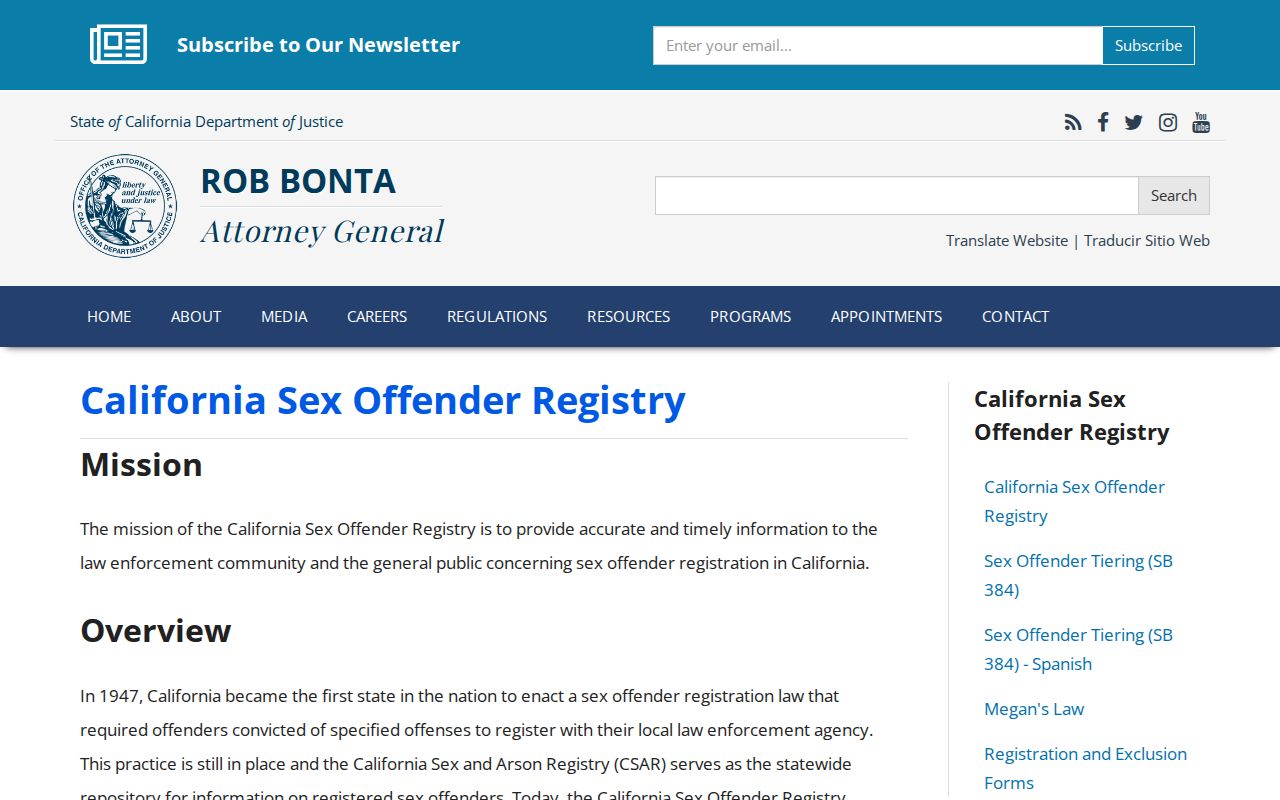
The California Megan's Law registry carries warnings against harassment and discrimination. A result is not proof of every address or person on a block, and it should not be merged with parcel data as a watch list. Public availability never authorizes following, threats, impersonation, or harmful publication.
Lawful use. Manhattan Beach neighbors research supports personal history, reconnecting, civic understanding, and reasonable safety awareness. No record should be used to stalk, harass, intimidate, or harm anyone.